Knauss legislative fellowships in Congress help build careers — and they're fun and educational. See our video and fact sheet for details.
A Brief History of Poplar Island
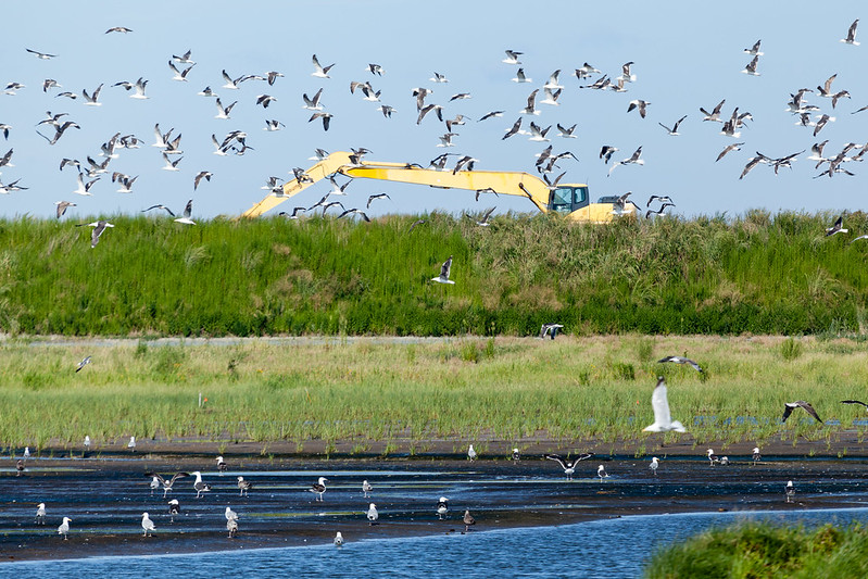
On Maryland’s Eastern shore, a single tract of land supports more than 250 species of birds, including bald eagles, double-crested cormorants, and American black ducks. Birdwatchers have spotted less common species like the Blackburnian warbler, North America’s only orange-colored warbler, which uses the island to rest while migrating to their forest breeding grounds in the north.
The island’s beaches also support a large population of Maryland’s state reptile, the diamondback terrapin, which requires sandy soil to lay its eggs during the summer months. Nearby in shallow waters, the common periwinkle snail and other aquatic critters find shelter among the plants. Would you believe that the foundations of this vibrant Chesapeake Bay scene are dredge materials used to rebuild Poplar Island?
Poplar Island, part of Talbot County, Maryland, is due west of Tilghman Island. Poplar Island is one of many islands in the Chesapeake Bay and is similar to some of its better-known “cousins” to the south, like Smith and Tangier Islands. In the mid-to-late 1800s, Poplar Island’s landmass was at least 1,100 acres. A census revealed about 100 people were living, working, and going to school on the island.
A long-term, quaint island life was not to be, however, as residents grappled with mother nature’s powerful forces of erosion. Historic navigational maps from the National Oceanic and Atmospheric Administration (NOAA) revealed that the island had shrunk to all but about 5 acres by the 1990s, at which point, all the island’s residents had long since moved away.
Poplar’s near demise is a common story in the Chesapeake. In Dorchester County, Maryland, Holland Island used to host a similar population in the early 1900s. Erosion, aided in part by a few wayward tropical storms, caused the island to largely disappear. In 2010, the last remaining structure collapsed. At high tide, no part of the island is visible.
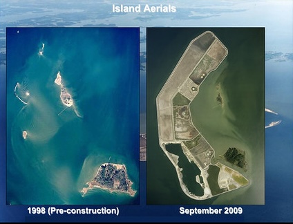
Poplar Island was saved from total loss through a serendipitous twist of fate and was slated to be restored. The island’s new purpose was to serve as a haven for all sorts of wildlife. How does one re-create an island that was once greater then 1000 acres? Well, you first need a lot of sediment. That sediment, known as dredge material, is sourced from shipping channels found all over the Chesapeake Bay. The channels are routinely deepened to maintain appropriate navigational depths for the large vessels that travel to ports such as Baltimore.
Maintaining the navigational channels is one responsibility of the United States Army Corps of Engineers but placing the dredge material somewhere on land was another issue entirely. This big question was answered when state legislators prioritized restoration of tidal environments. Many agencies gathered to agree that re-building Poplar Island would help restore tidal environments that have been lost due to erosion; some estimates show more than 10,000 acres of land loss in the mid-Chesapeake Bay since 1870.
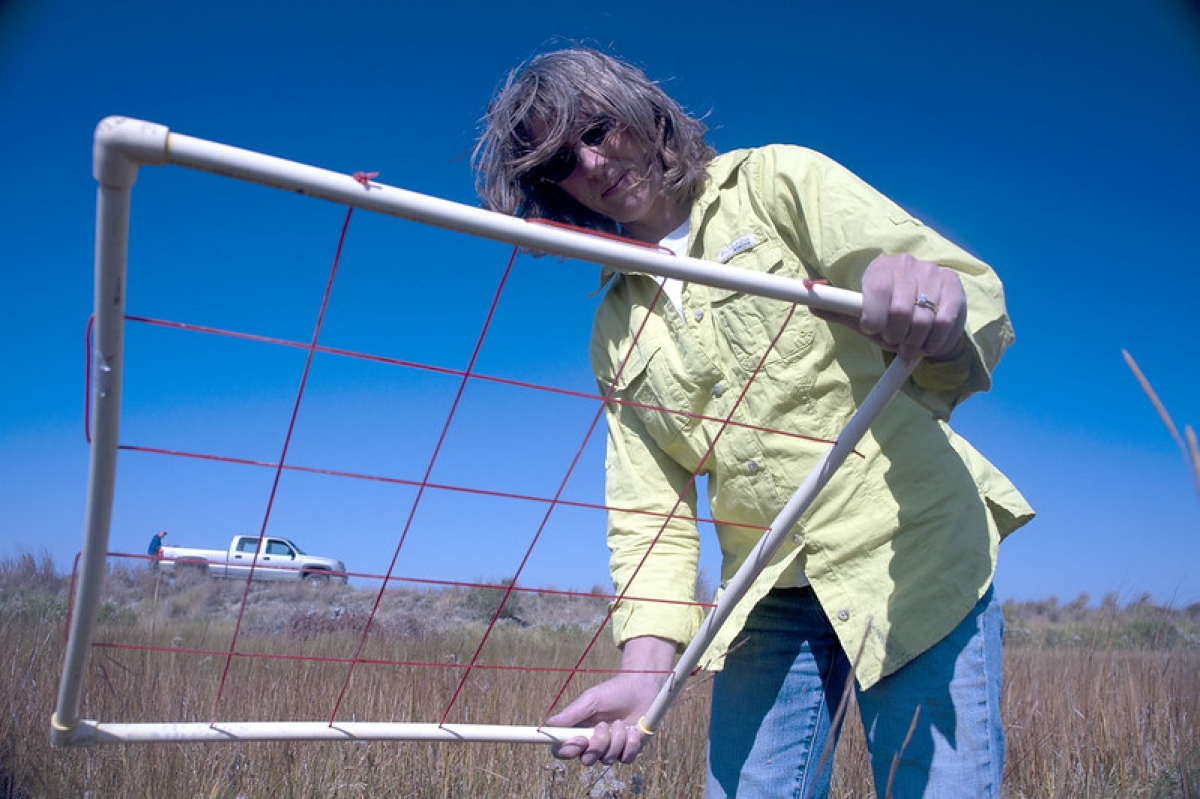
With restoration efforts, Poplar Island has grown to more 1,140 acres. In the present, the island’s eastern half is a lush refuge of marsh habitats. Its western half comprises unfinished but partially constructed upland habitats. If you have the opportunity to visit, you will be afforded a unique experience at one of the largest restoration projects in the Chesapeake Bay region. If you’re lucky enough to be invited to participate in fieldwork, you’ll likely experience a glorious sunrise as you take the 7 a.m. boat to the island, hear bird calls from great blue herons, and walk through lush meadows of saltmarsh hay and other grasses.
What does the future hold for Poplar Island? Dredge material will be imported to the island for at least five more years, and construction will continue for about two more decades. More dredge material will create additional habitat for the many species that the island supports. Additionally, material placement serves as an important large-scale test of scientific hypotheses surrounding successful restoration of marsh habitat.
Top left image: A bird rests on a nest on Poplar Island. Photo: Nicole Lehming
See all posts to the Fellowship Experiences blog

