The Effect of Tides and Elevation on Wetland Plant Communities
School:
Northern Middle School / Northern Garrett High SchoolLesson Plan Standards
1.1.2 1.2.3 1.2.4 1.2.7 1.4.1 1.4.2 1.4.5 1.4.6 1.4.9 1.5.2 1.5.4 1.5.5 1.5.6 1.5.8 3.5.1 3.5.2 3.5.3Lesson Summary
The main purpose of this lesson is to help students understand how tides can impact shoreline plant communities through the study of a freshwater tidal marsh. Other purposes are 1) to use actual tidal data to show students that tidal ranges differ among geographic locations, even those relatively close together and 2) to compare a freshwater tidal marsh to a peatland.
Before completing this lesson, students should understand basic tidal concepts such as the cause of tides, the tide cycle, spring tides, and neap tides.
 A beneficial lesson plan about tides that covers these topics can be found here. This lesson focuses on the Chesapeake Bay watershed, particularly a tidal freshwater marsh within the watershed called Dyke Marsh. The lesson can be modified to become a study of a different watershed and/or tidal freshwater marsh to make the lesson more relevant for the students involved. It would be useful to have a map(s) of the area used that students can refer to throughout the lesson.
The lesson follows the 5E model (engage, explore, explain, extend, evaluate.) In the engagement phase, both the classroom teacher and the students will determine what they already know about wetlands and wetland plants. The students read a short article about wetland plants and discuss a set of questions in small groups.
During the exploration phase, the students will use actual tidal and elevation data from a tidal freshwater marsh to create a topographic profile of an area of the marsh and determine what types of plant communities would be found along the profile.
The explanation phase begins with the students responding to a writing prompt that summarizes the main concepts of the exploration phase. After they have completed this, the teacher shows a slide show of a tidal freshwater marsh, featuring the distribution of plant communities.
In the extension phase, students compare tidal data from two different locations and compare a tidal freshwater marsh to a peatland.
Most of the evaluation is accomplished by assessing the activities completed by the students during the other phases of the lesson. The evaluation also includes revisiting the discussion questions presented in the engagement; this gives the students an opportunity to modify or change their responses.
Research Experience:
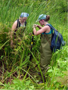
Ms. Kenyon worked with Dr. Katharina Englehardt of the Appalachian Laboratory, University of Maryland Center for Environmental Science, in Frostburg, Maryland, as part of the Environmental Science Educational Partnership Chesapeake Teacher Research Fellowship during the summer of 2004. The research project concerned “The effects of tides and elevation on wetland plant communities." Dr. Cat Stylinski of the Appalachian Laboratory served as the fellowship advisor.Recently, Ms. Kenyon-Sisler has received a prestigious environmental award, 2014 Tawes Youth Award for a Clean Environment, and has lead her AP Environmental Science students in stream restoration for brook trout. Read more at,http://garrettcountyschools.org/news/2014/04/nhs-ap-environmental-receives-award5E For This Lesson Plan
Engagement
Engagement
This activity captures the students' attention, stimulates their thinking, and helps them to access prior knowledge.
What do you know about wetlands?
By reading a short article, students will learn about what areas are considered a wetland and about some basic characteristics of wetland plants. Through small group brainstorming and class discussions, students will begin thinking about how wetland plants could be affected by tides.
Exploration
Exploration
In this section students are given time to think, plan, investigate, collect and organize information.
Always, sometimes, or rarely inundated?
Using elevation data of a tidal freshwater marsh, students will create a topographic profile of one section of the marsh. Using tidal data for a tidal freshwater marsh, students will determine the relative amount of time that different sections of the marsh are inundated with water. Using descriptions of various wetland plants, students will determine at which elevation level(s) these plants would establish communities within a tidal marsh.
Explanation
Explanation
Students are now involved in an analysis of their own explorations. Their understanding is clarified and modified because of the reflective nature of the activities.
What did you learn about wetlands?
Students will clearly communicate in writing what they have learned about the effect of tides and water level on wetland plant communities. Through a slide show, students will see actual photographs of plants in a tidal freshwater marsh, with a focus on their location in the marsh relative to elevation and water inundation.
Extension
Extension
This section gives students an opportunity to expand and solidify their understanding of the concepts and to apply them in a real-world context.
Is this true for all wetlands?
Using tidal data, students will compare the tidal range of two geographic locations. Students will compare a tidal freshwater marsh and a peatland in regard to how hydrology affects the distribution of plant communities in the two wetlands.
Evaluation
Evaluation
This performance-based activity helps students to connect all of the pieces of information involved in these lessons.
What have you learned about wetlands?
The students understanding of the concepts and topics explored during the lesson will be assessed.


